Figures
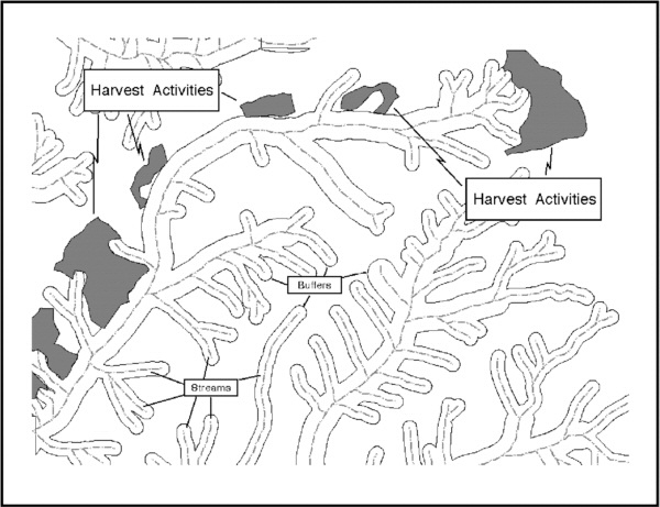
1. Buffering Streams
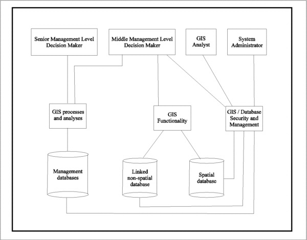
2. Levels of GIS
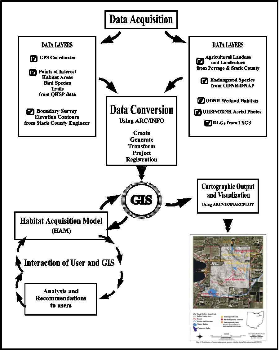
3. The Quail Hollow State Park GIS
Project
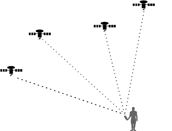
4. Ground Truthing using GPS
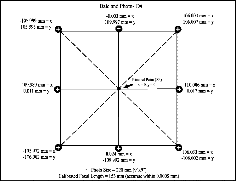
5. Camera Calibration Coordinates
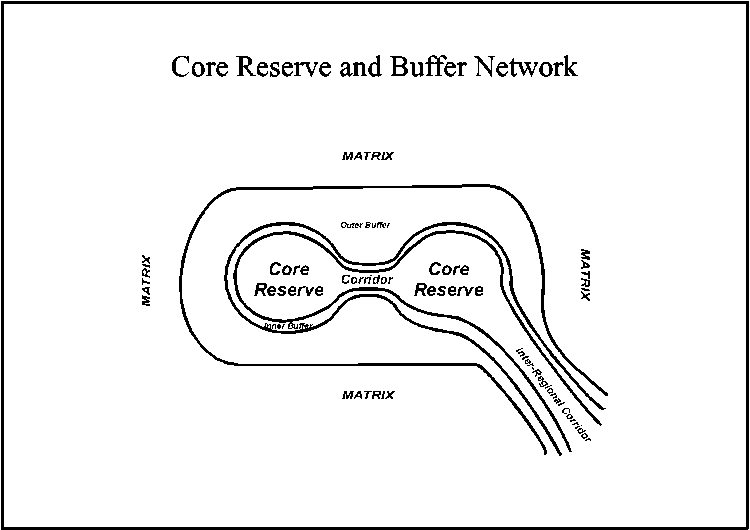
6. Core Reserve and Buffer Network
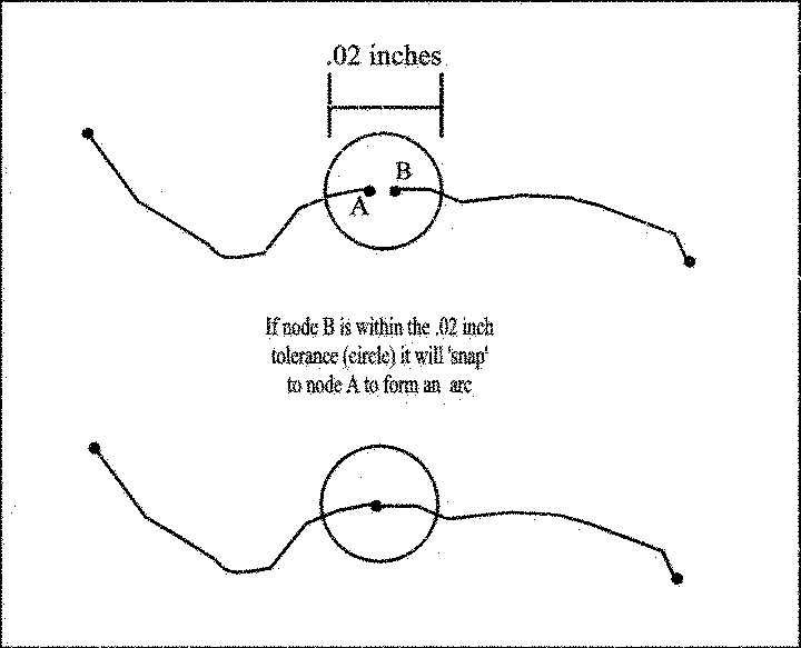
7. Digitizing Accuracy
8. CAD DXF File
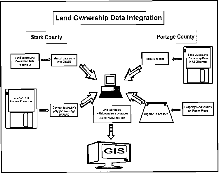
9. Data Integration for Portage and
Stark Counties
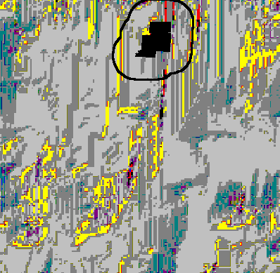
10. Errors in USGS DEM
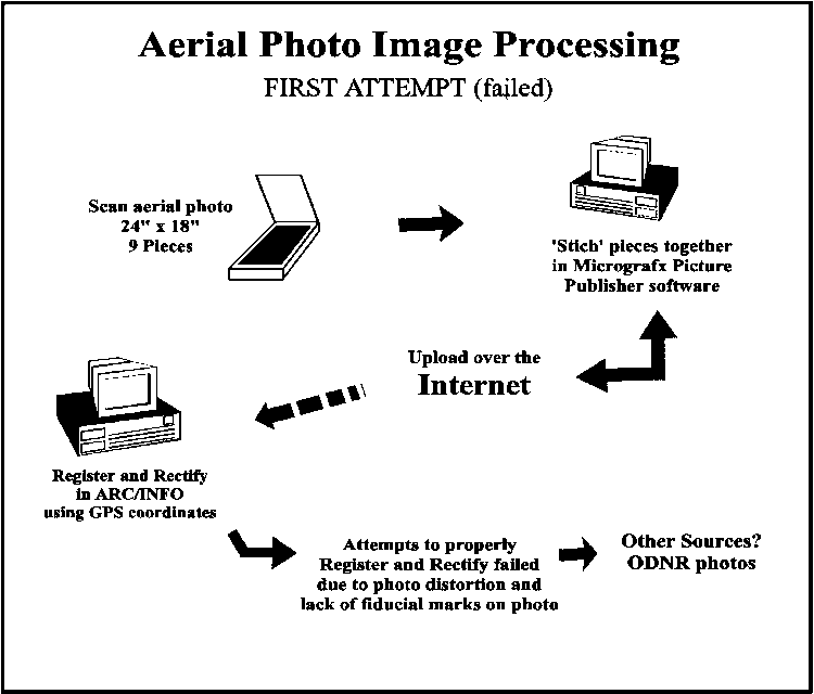
11. Aerial Photo Registration - First
Attempt
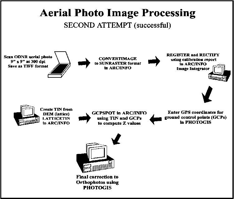
12. Aerial Photo Registration - Second
Attempt
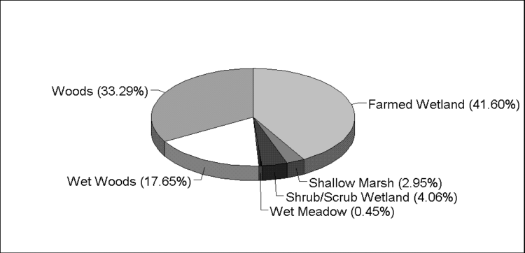
13. Percentage of Wetland Habitat in BSA
14. The Habitat Acquisition Model (HAM)